


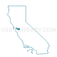
Voting District 30875, Alameda County, California
About
Outline

Summary
| Unique Area Identifier | 528827 |
| Name | Voting District 30875 |
| County | Alameda County |
| State | California |
| Area (square miles) | 12.21 |
| Land Area (square miles) | 10.61 |
| Water Area (square miles) | 1.60 |
| % of Land Area | 86.92 |
| % of Water Area | 13.08 |
| Latitude of the Internal Point | 37.76482490 |
| Longtitude of the Internal Point | -122.26509040 |
Maps


Graphs
Select a template below for downloading or customizing gragh for Voting District 30875, Alameda County, California


Neighbors
Neighoring Voting District (by Name) Neighboring Voting District on the Map
- Voting District 06218, San Francisco County, CA
- Voting District 30950, Alameda County, CA
- Voting District 30995, Alameda County, CA
- Voting District 31000, Alameda County, CA
- Voting District 31030, Alameda County, CA
- Voting District 31035, Alameda County, CA
- Voting District 31050, Alameda County, CA
- Voting District 41535, Alameda County, CA
- Voting District 51855, Alameda County, CA
- Voting District BAY, Alameda County, CA
Top 10 Neighboring County Subdivision (by Population) Neighboring County Subdivision on the Map
- San Francisco CCD, San Francisco County, CA (805,235)
- Oakland CCD, Alameda County, CA (411,480)
- Alameda CCD, Alameda County, CA (73,812)
Top 10 Neighboring Place (by Population) Neighboring Place on the Map
Top 10 Neighboring Unified School District (by Population) Neighboring Unified School District on the Map
- San Francisco Unified School District, CA (805,235)
- Oakland Unified School District, CA (390,785)
- Alameda City Unified School District, CA (73,812)
Top 10 Neighboring State Legislative District Lower Chamber (by Population) Neighboring State Legislative District Lower Chamber on the Map
Top 10 Neighboring State Legislative District Upper Chamber (by Population) Neighboring State Legislative District Upper Chamber on the Map
Top 10 Neighboring 111th Congressional District (by Population) Neighboring 111th Congressional District on the Map
- Congressional District 8, CA (666,827)
- Congressional District 13, CA (665,318)
- Congressional District 9, CA (648,766)
Top 10 Neighboring Census Tract (by Population) Neighboring Census Tract on the Map
- Census Tract 4283.02, Alameda County, CA (7,074)
- Census Tract 4283.01, Alameda County, CA (6,526)
- Census Tract 4282, Alameda County, CA (6,259)
- Census Tract 4273, Alameda County, CA (4,896)
- Census Tract 4277, Alameda County, CA (4,866)
- Census Tract 4276, Alameda County, CA (4,722)
- Census Tract 4281, Alameda County, CA (4,651)
- Census Tract 4278, Alameda County, CA (4,640)
- Census Tract 4279, Alameda County, CA (4,567)
- Census Tract 4061, Alameda County, CA (4,381)
Top 10 Neighboring 5-Digit ZIP Code Tabulation Area (by Population) Neighboring 5-Digit ZIP Code Tabulation Area on the Map
- 94501, CA (60,212)
- 94601, CA (50,294)
- 94606, CA (36,672)
- 94621, CA (29,870)
- 94607, CA (24,978)
- 94502, CA (13,600)